After my Saturday morning work shift, Rod and I packed up my car and drove straight to Te Araroa (minus the gas/grocery/coffee stop). It's a good thing we didn't make any scenic stops, because we didn't end up getting to town until after 6, we didn't find our campsite until after 7pm, which left us cooking and eating dinner at dusk!
The town centre of Te Araroa was hopping!.....NOT.
The resident population of the entire township is only 174 people, so it's not surprising that the town was this dead.
However, this town *is* home to the largest pohutakawa tree in the WORLD!
It's name is Te Waha o Rerekohu.
It makes Smokey (my car on the right) look teeny tiny!!
Te Araroa, the most easterly point in mainland NZ, is also the gateway to the East Cape Lighthouse (17km away). This is where one can be the first in New Zealand to see the sunrise!!!
We did a timed test drive out to the lighthouse (nice gravel road) and then backtracked and found this beach campsite. Quite crowded huh? (Note Smokey and the Tent on the far right)
So, after a twilight dinner and a quick sleep, we awoke suuuuuuper early to drive out the 17km gravel road then climb the 700 steps(!) to the East Cape Lighthouse to see the sunrise.
When we started climbing, it was dark.
See that tiny speck of light above? Yep, that's the lighthouse.
Anal time-keeper me was SO worried we were gonna miss the sunrise, that we pretty much hoofed it up the 700 steps without stopping once.
But alas, it was STILL dark when we got to the top. :)
So we waited. And eventually, dawn started to break.
In case you can't see, that's my watch, and it said 5:47. *yawn*
But seeing that blazing orange sun peak over the edge of the ocean clouds to start the day was SOOO worth it!
Initially, I was all excited because I thought we were to be the first in the WORLD to greet the new day. But, as of January 1, 2012, those idiots in Samoa decided to change which side of the International Date Line they were on (who knew you could do that??), so now Samoa is the first place in the world to greet the new day. New Zealand is 2nd. Oh well, it was still pretty awesome. :)
Here's the East Cape lighthouse just after sunrise.
The light in the Lighthouse first shone in 1900. The lighthouse originally was located on the small island seen in some of the earlier photos above. However, a string of earthquakes caused the ground to slip so much that they moved it to the mainland in 1922 to be safer. It's 14 meters high. It was kept up by a lighthousekeeper until 1985 (walking those 700 steps every day would've been a lovely commute to work!). Now it's all computer run.
So, as for the steps.... all 700 of them...
Some were straight..
Some were curvy....
And some were quite rickety and need of replacement!
But all in all, it wasn't a bad climb at all. Took us around 10-15 minutes I'd say. Climbing up the Mount here in Mount Maunganui was definitely good training!
Here is a view of the East Cape, the Pacific Ocean, and the Lighthouse wayyyy up top.
After that gorgeous sunrise, we went back to our campsite, had a bit of a nap (5am wakeup was pretty brutal!), then mid morning headed around the East Coast to further our East Cape adventure.
There was some forest inland driving, and not as many scenic stops as on the first half of the mission I previously blogged about, but the few stops there were along the East Coast were quite amazing.
Here is Tokomaru Bay, which was the site of an old freezing works company. The old wharf used by the company was rickety, but still intact. Gorgeous!
We had a nice picnic lunch here and walk on the beach.
Next stop was Anarua Bay. Our tour book said "well worth the 7km drive off the main road", and indeed it was! Apparently Captain Cook berthed his ship here, and was welcomed by the local Maori tribe. He picked a dang good spot!!
The day was quite warm, so we slipped into our togs (bathing suits) and went for a swim here as well.
Two dogs decided to become quite friendly with us.
This one took an affinity to Rod...
And this shaggy sand/furball was quite curious in me and my towel. He was scratching lots, and I was scared to death he was gonna give me fleas.
(He didn't, thankfully.)
Next stop was Tolaga Bay, home of the longest wharf in New Zealand, and debated to be the longest in the Southern Hemisphere!
600 meters long!
It looks pretty from far away, but close up, it's falling apart.
(Yes, still walked on it!) It's no longer used for commercial business/shipping/etc, but fishermen still use it--- there were dozens of folks fishing on it when we were there.
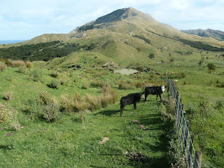
There's a fantastic 2.5 hr walk in the area too, called Cook's Cove Walkway. The first portion is over some farmland...
Rod on left, cow on Right :)
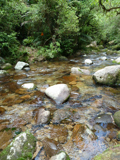
The walk then takes you down into some forests, then out again to the coast.
One sight to see was called "Hole in the Wall"
Literally a hole, in the wall (rock).
The endpoint of the walk can be seen below. This is Cook's Cove, where, in 1769, Captain Cook berthed the HMS Endeavour in order to repair the ship and restock supplies.
My buddy Alastair took one look at this picture and commented, "bet they had lamb for dinner that night!" ;)
Interesting factoid: all the streets in the town of Tolaga Bay are named after Captain Cook's crew.
(I doubt if Christopher Columbus did that in America anywhere!!)
We liked Tolaga Bay so much, we decided to buy a house there. No, just kidding. But we did decide to stay the night at the campsite, right by the Bay.
Complete with takeaway fish and chips for dinner at the campsite, a great night!!
AND NO FOOD POISONING! Hooray!
The next morning we packed up and drove the last few dozen km's to get to our final destination of the East Cape--- Gisborne!
All the way around the East Cape, food poisoning free! SUCCESS.
Here's a view looking over Gisborne city. Nothing too special here, other than (usually) nice weather. It was a humid overcast day, so I wasn't too impressed.
We stopped at a winery for lunch and then started our trek home.
Instead of taking the superlong coastal route back home, there's a much shorter inland alternative through the Waioeka Gorge. This area is actually a scenic reserve, too. The roads were quite windy and not much traffic on them. And apparently, quite dangerous. Due to so many accidents occuring
along this stretch of road, the NZ Transport Agency and the Department of Conservation sent up an eco-cultural display with many stops along the 2.5 hr drive to encourage safe driving and preventing driver fatigue.
One of the stops was the Manganuku Bridge.
It was built in 1928 and is one of the few remaining Howe truss hardwood bridges in New Zealand.
(if you're an architect and you understand that last sentence, please let me know!!)
The main highway actually used to pass through this area. The bridge closed in 1964 and was replaced with a big concrete one, used today.
Another scenic stop to help me stay energized and safe was at the Tauranga Bridge, seen below.
For all you architect folks, it is one of the only 2 single span harp suspension bridges remaining in New Zealand.
This one is still open to foot traffic only. It was quite bouncy--- I'd definitely never trust Smokey on it!
At this time I was done with the sightseeing and ready to just get home. We made it safely to Ohope Beach, stopped for an ice cream (MUCH better for my driver fatigue than looking at some bridge!), and made it safely back to Mount Maunganui.
So there you have it--- a successful completion of the East Cape Adventure. Couldn't have done it without my trusty navigator and travelling companion. Thanks Rod!
So there you have it--- a successful completion of the East Cape Adventure. Couldn't have done it without my trusty navigator and travelling companion. Thanks Rod!
Til the next adventure!


